Leading CAD Outsourcing Company offers solutions of Engineering CAD Services, Design Drafting & 3D Modeling
Email us:
info@truecadd.com
info@truecadd.com
Leading CAD Outsourcing Company offers solutions of Engineering CAD Services, Design Drafting & 3D Modeling
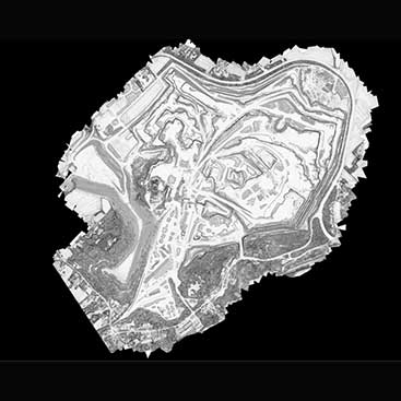
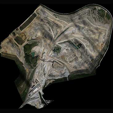
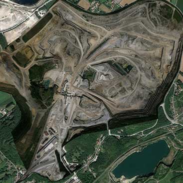
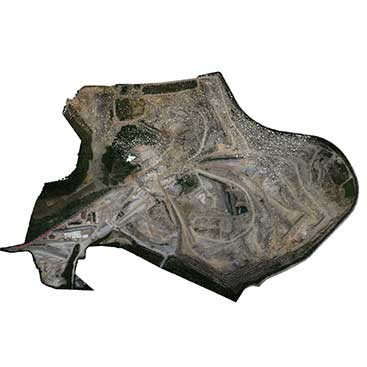
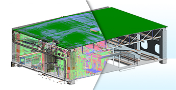
Developed CAD Drawings from Drone-Scanned Data for a Mining Site, France
Client Profile:Scanning and Data Consultant
Industry:Infrastructure Development
Inputs:Configuration, DSM, Log, Model, Acquisition Details, Orthophotography, Point Cloud Data, Slope Degree
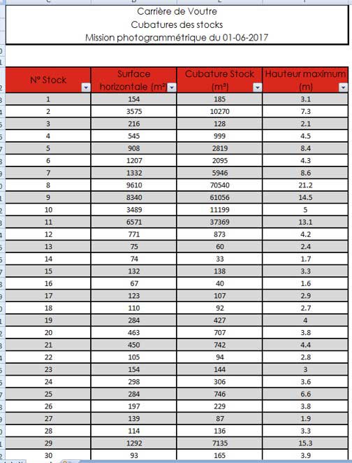
Deliverables:CAD Drawings, Final stockpile volumes with a detailed Excel report
Software Used:


Let’s Talk.
Optimize your mining workflow with precise Point Cloud to CAD conversion.
Contact our BIM specialists →Business Needs:
- Transform drone-generated point cloud data into accurate CAD drawings.
- Evaluate terrain elevation, contours, and slope gradients to plan safe mining operations.
- Generate precise terrain models, haul road alignments, and stockpile measurements for informed decision-making.
- Create engineering-grade CAD documents to enhance mine safety and improve excavation workflows.
Project Challenges:
- Analyze irregular terrain conditions, road sub-base, and complex geological formations.
- Map steep embankments and densely vegetated areas for accurate safety-berm placement.
- Detect minor cracks and fissures within high-density point cloud datasets.
- Preserve geometric accuracy and scale during CAD conversion.
Our Solutions and Approach:
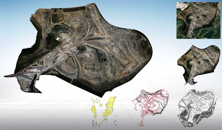
A France-based Scanning and Data Consultant approached TrueCADD to process drone-scanned data of a mining site and develop detailed CAD drawings.
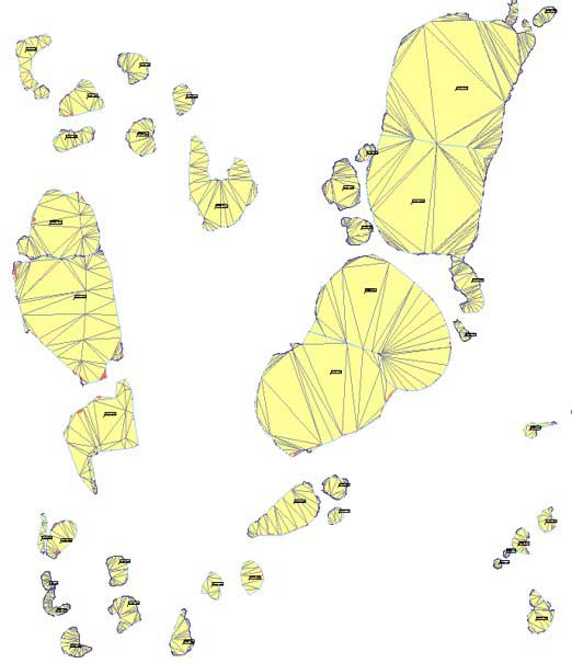
- Converted drone-scanned point cloud data into high-precision 2D/3D CAD engineering drawings.
- Analysed site topography to plan haul roads, safety berms, quarry faces, drainage paths, and stockpile volumes.
- Used AutoCAD and GEOMENSURA to produce fully geo-referenced, survey-accurate CAD deliverables.
- Developed an Excel-based reporting system for lifecycle analysis and project documentation.
Business Impact:
- Enhanced planning accuracy with standardized, survey-ready CAD outputs.
- Streamlined workflows via a robust QA/QC matrix.
- Improved site safety using precise terrain and geospatial data.
- Enabled faster decisions with reliable geometry and accurate volumetric data.
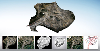
Project Samples
CAD Conversion for Mining Site

CAD Conversion Mining Site

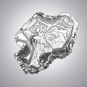
Surface Mining Plan France

Surface Mining Plan
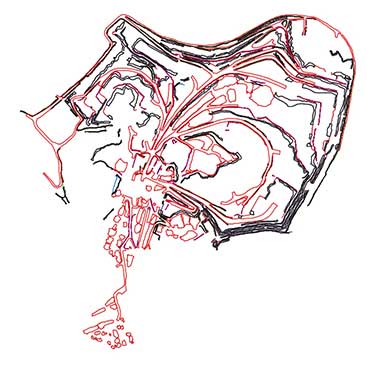
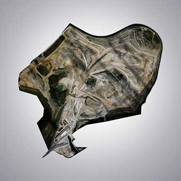
Point Cloud to CAD Conversion for Mining Plan
Point Cloud to CAD Conversion
Point Cloud Modeling
Point Cloud Conversion
Point Cloud to CAD Conversion for Surface Mining Plan
Related Case Studies
Need help on an ongoing basis?
We establish long term business relationships with clients and are committed to total customer satisfaction.
Home |
Sitemap |
Privacy Policy |
Data Security & Confidentiality |
Contact us
|
![]()