Point cloud modeling has revolutionized renovation projects by plugging in the power of laser scans into BIM. Point cloud conversion of laser scan data into 3D models helps surveyors and construction firms resolve critical challenges, as the geometries of all building assets and their as-built conditions can be captured with high accuracy.

Leading CAD Outsourcing Company offers solutions of Engineering CAD Services, Design Drafting & 3D Modeling
Email us:
info@truecadd.com
info@truecadd.com
Leading CAD Outsourcing Company offers solutions of Engineering CAD Services, Design Drafting & 3D Modeling
Point Cloud Conversion to 3D Modeling: The Modern Road to Renovation
Updated on September 30th, 2026
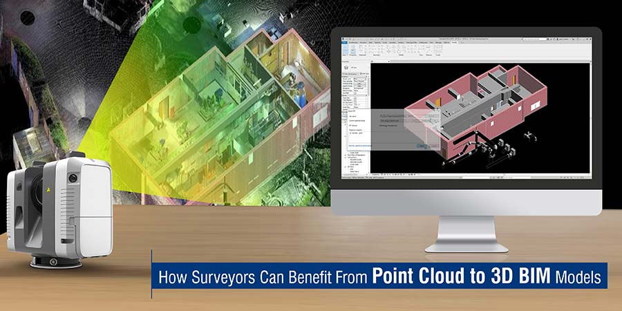
Table of Contents
- Decoding the tech: What is point cloud conversion to BIM?
- What are the challenges of using legacy processes and tools in surveys?
- Key benefits of point cloud to 3D modeling
- Best practices to get an optimal 3D point cloud to BIM model
- Why ReCAP and Revit the most powerful software are tools to create 3D models?
- Benefits of outsourcing BIM modeling for renovation projects for surveyors
- Conclusion
Renovation projects of buildings of high significance, including heritage monuments, are difficult to execute with legacy tools and traditional surveying methods. Using conventional tools leads to spatial inaccuracies in surveys and consequent issues in accurate retention of the architectural essence of a structure.
Point cloud conversion of laser scan data to 3D models offers a non-invasive tool to surveyors that significantly reduces surveying time, can capture every detail, derive information accuracy, lower risks, and achieve positive project outcomes.
A point cloud to BIM model created using Revit, delivers in-depth visualization of Mechanical, Electrical, Plumbing and Firefighting (MEPF) equipment within cramped spaces, resulting in enhanced visualization capabilities for renovation and retrofitting.
Point cloud modeling helps in accurate and complete documentation of as-built conditions to enable architects, structural engineers, and surveyors understand the intricacies of a heritage structure and preserve it. Provided with the right data set as input including drawings, scans, 360-degree photos, and other information, a coordinated as-built 3D model can help from creating accurate surveys to designing effective facilities management.
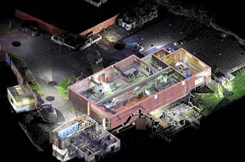 Scan to BIM Conversion
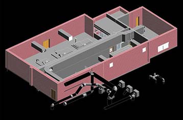 Point Cloud BIM Modeling
Need an accurate 3D model from your laser scan data?
Contact us Now»Decoding the tech: What is point cloud conversion to BIM?
Point cloud to BIM conversion or point cloud modeling of laser scan data in BIM, involves creating a 3D model from millions of data points scanned by a laser scanner and aggregated into a point cloud. A point cloud to BIM model is built within BIM tools like Revit ensuring data accuracy and integrity. This coordinated 3D model in a virtual space is used for renovations, remodels, and facilities management.
The process of transforming laser scan to 3D BIM modeling begins with data acquisition. A 3D laser scanner is used to record the physical attributes of the site or structure, forming a dense collection of data points, or a “point cloud.”
This raw data is then processed using specialized software, cleaned, and filtered to remove noise and irrelevant points. Multiple scans from different perspectives are then registered and aligned in a process called ‘stitching,’ to create a holistic and accurate 3D depiction of the site. The incorporation of scan to BIM benefits enhances the accuracy of the model and facilitates more efficient workflows.
With the completion of the point cloud, it’s imported into BIM software like Autodesk Revit. The BIM model is created by tracing over the point cloud data, forming the elements of the building including walls, floors, roofs, and systems like Mechanical, Electrical, Plumbing, and Fire Protection (MEPF).
This model’s accuracy is cross verified against the original point cloud data, ensuring true representation of as-built conditions. Once validated, the model helps in further design, analysis, or facility management, and to enhance collaboration and reduce error risks.
What are the challenges of using legacy processes and tools in surveys?
- Absence of visualization increases risks in accurate reconstruction of pre-existing conditions.
- 2D drawings are unable to delineate the spatial requirements of the building.
- CAD-based assets lack the capabilities needed for estimation accuracy.
- Inaccurate and incomplete data leads to shortcomings in operational productivity.
Key benefits of point cloud to 3D modeling
360-degree visualizations with 3D model reduces risks in assessing pre-existing conditions
The presence of 360-degree visualizations in 3D at the required LOD helps surveyors to accurately document pre-existing conditions thus lowering renovation risks. Clash-free and validated data within the point cloud to BIM model, combined with parametric design, help generate faster design prototypes and lead to more effective design outcomes.
Point cloud to 3D model conversion helps in determining the spatial needs of the building
Data accuracy and completeness within a 3D model helps architects, structural engineers, MEPF professionals, and surveyors to assess spatial needs better for design understanding, collaboration, and decision-making. Point cloud modeling empowers contractors by enabling complete spatial analysis, aiding in the resolution of design and constructability issues before actual construction begins.
Coordinated 3D scan to BIM models aid in generating accurate project estimates
Using an as-built 3D model in 5D BIM (including time and cost dynamics), project estimators can easily make realistic cost estimates. Extraction of accurate documentation from a 3D model helps in creating precise BOQs and BOMs, calculate accurate asset costs, reduce waste, and lower costs for renovation, remodeling, and facilities management.
Availability of accurate and complete data drives greater operational productivity
Point cloud modeling helps surveying companies with the supply of high-quality digital assets needed for precision work. Visualization, accuracy, completeness, and data validity improve production value by cutting down on excess material use, mitigating overproduction, and reducing component design defects. Reduced need to revisit the site saves time, and improves turnaround time.
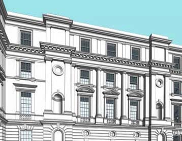 Scan to BIM Conversion
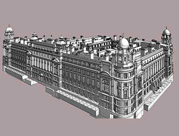 BIM Model at LOD 400
Best practices to get an optimal 3D point cloud to BIM model
The following tips ensure a point cloud to BIM model will garner high accuracy, lower project time, improve visualization, and drive recommended project mapping.
- Fixing a logical base point and coordinate system.
- Making sure the point cloud registration is precise.
- Removing unwanted noise from the point cloud data.
- Performing a thorough side-by-side comparison of the scans with drawings and pictures including 360-degree images.
- Reducing the point cloud dataset to avoid unnecessary processing and system performance lags.
- Review the building orientation for its resolution.
Why ReCAP and Revit the most powerful software are tools to create 3D models?
Autodesk ReCAP is a premier software to register, clean, and index raw data from scanners. If you are using ReCAP, it can help you process large datasets into smaller and manageable .rcp files. This helps surveying firms erase noise and align scans accurately. It also ensures your point cloud is effective and adds value for your BIM project.
Also, Revit is one of the leading BIM authoring tools to convert point clouds into smart 3D models. Once the ReCAP files are linked, stakeholders are able to track parametric floors, walls, and structural members over original scans. This fosters conflict detection, information-rich documentation, and swift collaboration.
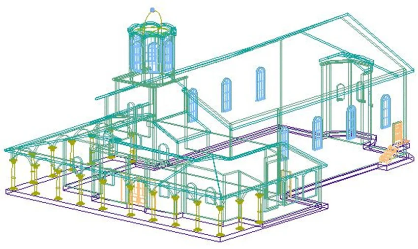 Source: researchgate.net
Success Story: Point Cloud conversion with +/-10mm accuracy reduces rework for a retail coffee outlet in the US
A building surveying firm from the US partnered with TrueCADD to develop an as-built model for facilities management without disrupting on going work. Scan data was provided by the client as input, which had duplicates and was not up to required standards. As the scanning was not done correctly, it had elevated modeling risks which had to be resolved quickly.
The team of BIM experts at TrueCADD cleaned and registered the point cloud data correctly and created a coordinated and clash-free 3D model at +-10 mm accuracy using Revit. Post approval from the client, building sections, floor plans and elevations were derived from the 3D model.
Once the model was quality checked to ensure standards were met, precise as-built drawings were also given to the client for further approval, all within the stipulated time. Upon handover of the deliverables to the client, it helped them:
- Improve building assessment with +-10 mm accuracy.
- Optimize client collaboration and decision-making.
- Mitigate rework and elevate efficiency.
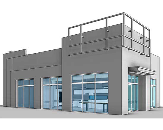 Point Cloud to Revit 3D Modeling
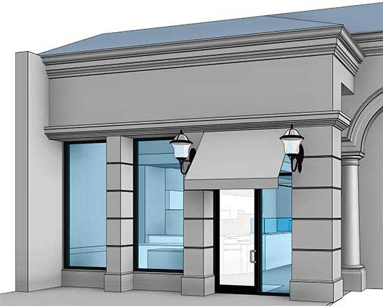 Entrance Elevation Details
Benefits of outsourcing BIM modeling for renovation projects for surveyors
As a surveying firm, you can leverage numerous benefits if you outsource 3D point cloud modeling needs to trusted BIM service providers like TrueCADD.
- You gain access to specialized resources and tools which reduces costs related to labor and operational expenses. With specialization in Scan to BIM workflows, they can help you extract complex features and improve Revit modeling.
- You get to take advantage of a faster turnaround as outsourcing partners do the heavy lifting for you. It does not matter how large and complex your project is. Even if there is a sudden surge in workload, resources can be ramped up as required.
- As a surveying firm you do not have to worry about investing a large capital amount for hardware, software, or training.
- You can spend important time on the site and build client relations rather than waste time on digital drafting.
Ready to cut costs and turnaround time on your next point cloud to BIM project?
Get in touch »Conclusion
As the article comes to a closure, you can easily say Point cloud conversion will continue to provide significant value for surveying firms. It would not matter if your project was complex or large; 3D point cloud modeling would navigate every obstacle and provide deliverables that are high-performance and efficient.
Point cloud to BIM is truly the modern road to renovation and there is no way you can neglect this technology for future retrofit or renovation projects. Also, if you are facing challenges in renovation and retrofitting, it is best to partner with a trusted BIM service provider like TrueCADD to leverage a greater business impact.
Get a free consultation for your next point cloud to BIM project.
Contact our team today →










Gaurang Trivedi
Gaurang Trivedi is engineering consultant at TrueCADD. Besides, donning multiple hats, as a website manager and marketing in charge, he also oversees the editorial content, coordinating and managing the website, its news sections, blogs and social media promotions as well.
Related Posts
Need help on an ongoing basis?
We establish long term business relationships with clients and are committed to total customer satisfaction.
Home |
Sitemap |
Privacy Policy | Data Security & Confidentiality |
Contact us |